TidiViews LogoTidiViews

SOLUTIONS CAPABILITIES

Intelligence modules engineered for dynamic coastlines

Our modular platform lets you deploy precision monitoring packages tailored to your specific coastal challenges.

Module A

Shoreline Detection

The Challenge

Shorelines are constantly shifts due to seasonal erosion, storms, and sand drifts, making manual surveys slow and costly.

Our Solution

Uses automated satellite tracking and high-frequency camera overlays to chart shoreline change, providing erosion hazard forecasts and sand drift analytics.
Module B

⁠Precision Coastal Observation & Analytic

The Challenge

In-situ wave buoys are expensive to deploy, maintain, and retrieve. They only provide point source measurements, leaving coastlines blind.

Our Solution

Transforms standard optical camera feeds (fixed or mobile) into wave spectra (Significant Wave Height, Wave Period, direction) and water level indicators. Zero marine construction, instantly deployable.

Module C

Wave Overtopping Detection

The Challenge

Critical seawall and port infrastructure face catastrophic flood risks when storm swells override containment structures.

Our Solution

Integrates edge vision sensors to instantly flag overtopping events, log splash volumes, and alert port authorities of potential structural erosion or road hazards.

SHOWCASE

Analytics showcase

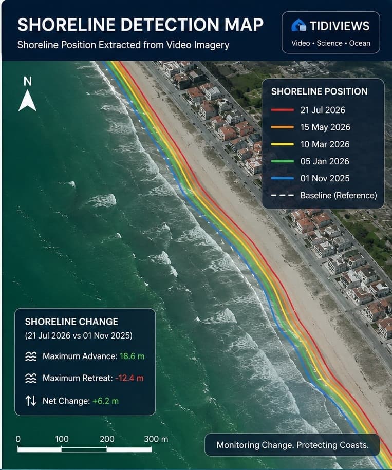
Real analytical outputs generated from computer vision intelligence at Costa Nova Beach, Portugal.

LOCATION

Costa Nova Beach, Portugal

OBSERVATION PERIOD

Nov 2025 – Jul 2026

MAX ADVANCE

+18.6 m

MAX RETREAT

-12.4 m

NET SHORELINE CHANGE

+6.2 m

Shoreline Detection Map

Need a customized intelligence deployment?

Connect with our application engineers to map out camera positions, satellite paths, and data formats for your site.